uganda's national parks
Kidepo Valley National Park
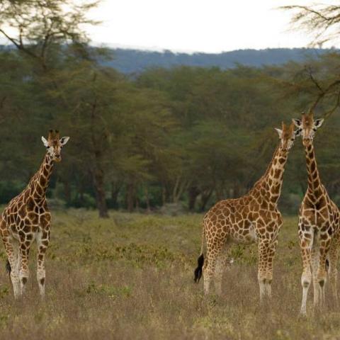
Kidepo Valley National Park lies in the rugged, semi arid valleys between Uganda’s borders with Sudan and Kenya, some 700km from Kampala. Gazetted as a national park in 1962, it has a profusion of big game and hosts over 77 mammal species as well as around 475 bird species.
Kidepo is Uganda’s most isolated national park, but the few who make the long journey north through the wild frontier region of Karamoja would agree that it is also the most magnificent, for Kidepo ranks among Africa’s finest wildernesses. From Apoka, in the heart of the park, a savannah landscape extends far beyond the gazetted area, towards horizons outlined by distant mountain ranges.
During the dry season, the only permanent water in the park is found in wetlands and remnant pools in the broad Narus Valley near Apoka. These seasonal oases, combined with the open, savannah terrain, make the Narus Valley the park’s prime game viewing location.
Park at a Glance
Size: 1,442km2
The park’s altitude ranges between 914m and 2,750m above sea level.
The park contains two rivers – Kidepo and Narus – which disappear in the dry season, leaving just pools for the wildlife.
The local communities around the park include pastoral Karamojong people, similar to the Maasai of Kenya, and the IK, a hunter-gatherer tribe whose survival is threatened.
Lake Mburo National Park
Lake Mburo National Park is a compact gem, located conveniently close to the highway that connects Kampala to the parks of western Uganda. It is the smallest of Uganda’s savannah national parks and underlain by ancient Precambrian metamorphic rocks which date back more than 500 million years. It is home to 350 bird species as well as zebra, impala, eland, buffalo, oribi, Defassa waterbuck, leopard, hippo, hyena, topi and reedbuck.
Together with 13 other lakes in the area, Lake Mburo forms part of a 50km-long wetland system linked by a swamp. Five of these lakes lie within the park’s borders. Once covered by open savanna, Lake Mburo National Park now contains much woodland as there are no elephants to tame the vegetation. In the western part of the park, the savanna is interspersed with rocky ridges and forested gorges while patches of papyrus swamp and narrow bands of lush riparian woodland line many lakes.
Park at a Glance
Size: 370km2
Altitude: 1,220m - 1,828m above sea level
Wetland habitats comprise 20% of the park's surface
The parks' precarious past has seen wildlife virtually eliminated several times: firstly in various attempts to rid the region of tsetse flies, then to make way for ranches, and finally as a result of subsistence poaching.
20% of the park's entrance fee is used to fund local community projects such as building clinics and schools.________________________________________
Rwenzori Mountains National Park
The Rwenzoris – the fabled Mountains of the Moon – lie in western Uganda along the Uganda-Congo border. The equatorial snow peaks include the third highest point in Africa, while the lower slopes are blanketed in moorland, bamboo and rich, moist montane forest. Huge tree-heathers and colorful mosses are draped across the mountainside with giant lobelias and “everlasting flowers”, creating an enchanting, fairytale scene.
Rwenzori Mountains National Park protects the highest parts of the 120km-long and 65km-wide Rwenzori mountain range. The national park hosts 70 mammals and 217 bird species including 19 Albertine Rift endemics, as well as some of the world’s rarest vegetation.
The Rwenzoris are a world-class hiking and mountaineering destination. A nine- to twelve-day trek will get skilled climbers to the summit of Margherita – the highest peak – though shorter, non-technical treks are possible to scale the surrounding peaks.
For those who prefer something a little less strenuous, neighboring Bakonzo villages offer nature walks, homestead visits home cultural performances and accommodation, including home-cooked local cuisine.
Park at a Glance
Size: 996km2
The park was gazetted in 1991 and was recognized as a World Herita